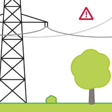
Why the topic is important
Regular inspections must be carried out to detect damage to the grid infrastructure at an early stage and rectify it as quickly as possible. This ensures that the transmission system remains available at all times and guarantees security of supply. The use of autonomous drone flights in combination with artificial intelligence opens up new opportunities for more efficient and safer inspections of extra-high-voltage lines and substations.
Project
Challenge
The Swiss transmission grid is a technical heavyweight: it consists of 6,700 kilometres of lines, 12,000 pylons and 147 switchgears as the basis for ensuring the reliable flow of electricity. However, around two thirds of the grid infrastructure is now between 50 and 80 years old. Age-related wear and tear such as corrosion on steel pylons is not the only problem. Climate change and extreme weather conditions are also having an impact, e.g. heat, storms, lightning, heavy rain, snow and ice – as well as avalanches, debris flows and rockfalls in mountain areas.
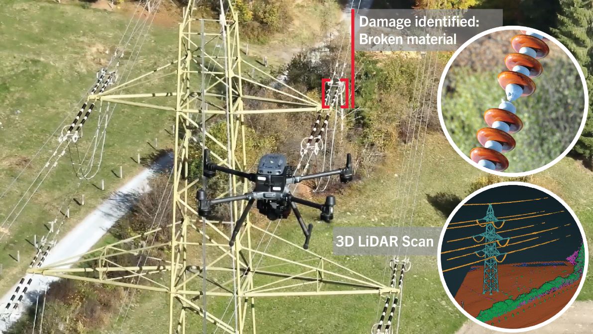
Until now, specialists conducted routine inspections from the ground or by climbing pylons. To detect damage to extra-high-voltage lines, for example a material break in an insulator string, specialists also have to access terrain that is sometimes steep and difficult to reach. This is time-consuming and poses safety risks.
As well as performing ground inspections, Swissgrid has been using drones since 2021. Aerial surveys and image analyses are gradually being automated but still involve various manual steps. The process therefore remains labour-intensive, time-consuming and prone to errors when analysing large volumes of data.
Solution
The «Maintenance of Infrastructure with Drones in Autonomous Flights» (MIDAS) project is taking the drone-based monitoring of overhead lines and other installations into the digital future. The aim is to digitalise and automate these processes one step at a time. This will make the maintenance of overhead lines and substations more efficient and safer.
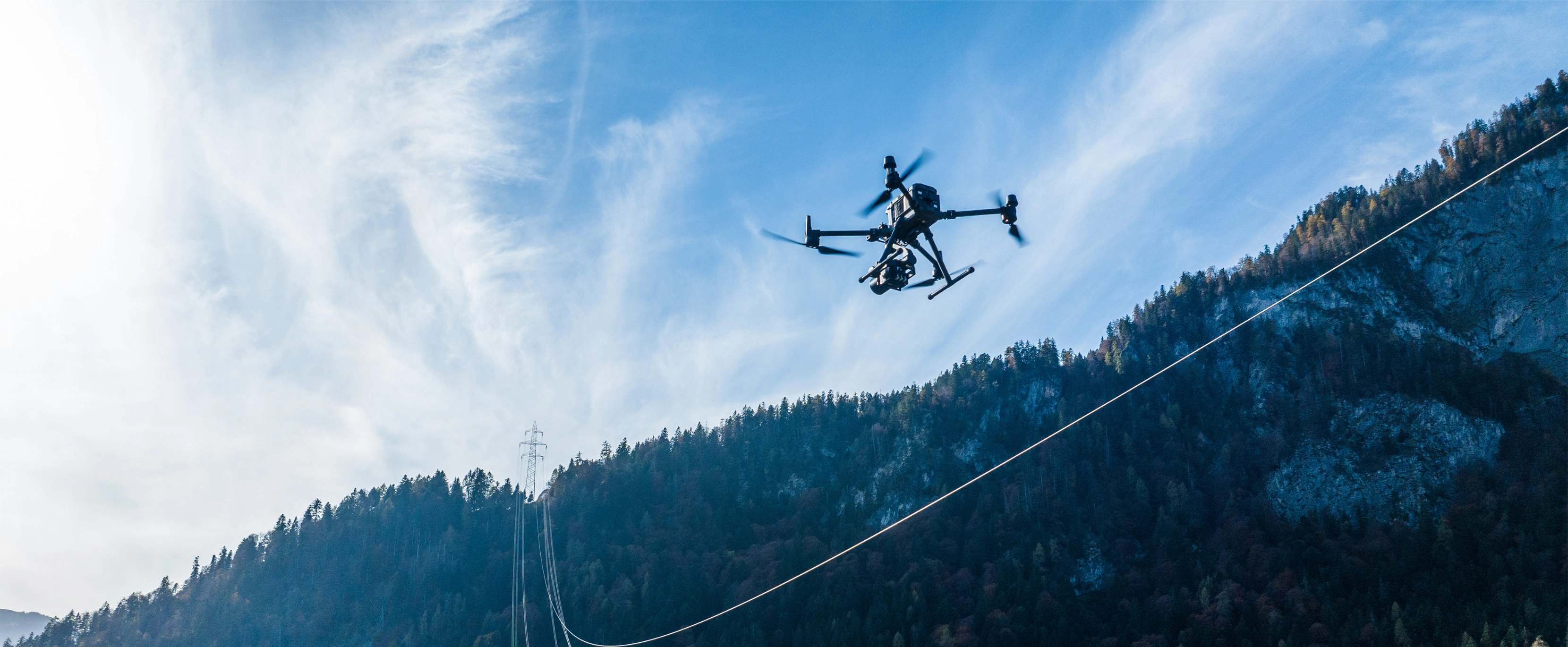
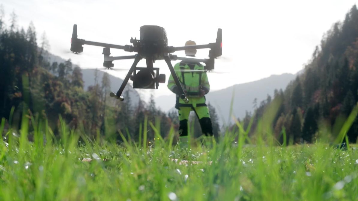
Drones carrying high-resolution cameras are used for inspections. Automated flight planning enables the drones to fly over routes autonomously and capture high-resolution inspection images of specific locations and grid elements.
Procedure
Swissgrid is gradually piloting new technologies and approaches to put them to the test. Every process is validated end-to-end, from the initial potential analysis and regional tests through to operational roll-out. The aim is to replace existing methods with efficient, automated solutions in the medium term and to firmly establish digitalisation in the company in the long term.
Technology
Various technologies are incorporated into the project. Together, they form the foundation for automated, digitalised grid inspection.
Benefits and results
During the pilot phase, a total of 8,900 pylons and 4,900 km of line routes were inspected from the air. This resulted in 1.5 million images, which were analysed for potential damage or anomalies using AI-assisted image analysis. 1,500 of these images were used for the Smart Image Database to train the AI model to detect anomalies and potential damage to the grid infrastructure.
The project team identified several critical cases, which were then examined in depth by the plant managers at Swissgrid. All the findings are incorporated directly into the «Asset Health Index» – a directory that records the health of Swissgrid’s assets. They therefore form a sound basis for predictive maintenance and the long-term security of the grid. The Smart Image Database plays a crucial role as a data base.
Swissgrid inspected the entire extra-high-voltage grid from the air between 2021 and 2025.
Data collected:
Advantages of autonomous drone flights
- Predictive maintenance: the condition of the grid can be monitored continuously and efficiently, and long-term trends can be analysed. In combination with AI models for evaluating images, drones allow preventive screening to detect damage or anomalies on overhead lines at an early stage before they become critical. This improves the hit rate during inspections, reduces costs and resource expenditure and extends the service life of the infrastructure, increasing security of supply as a result.
- Digitalisation and data quality: drones provide image data that is much more precise and complete than the data obtained during ground inspections. In contrast to manual inspections, digital recording with drones enables standardised data processing with no media discontinuity.
- Process efficiency: drones supplement or replace time-consuming manual processes and increase the degree of automation in asset management. They speed up routine inspections and disturbance analyses. After a disturbance, a drone can take off immediately to carry out an initial on-site assessment and quickly provide stakeholders with precise images of the extent of the damage. If repairs are necessary, measures can be taken more quickly and in a more targeted manner – this saves time and ensures that the grid infrastructure becomes available again as quickly as possible.
- Security: drones provide secure access to danger zones or difficult-to-access locations – without exposing people to risk. The advantage is particularly evident in mountainous regions: differences in altitude and challenging terrain can be overcome without complex logistics – considerably increasing employee safety and the security of systems and grid operations.
- Sustainability: drones are cost-efficient and have a lower CO2 footprint than helicopter flights. They can therefore help Swissgrid to meet its sustainability goals.
Current project status/outlook
The completed pilot phase forms the basis for a gradual roll-out towards standardised drone deployment for core applications. At the same time, the MIDAS project team is testing additional potential applications. Possibilities include vegetation management along lines or inspections in substations, especially after disturbances or exceptional incidents.
Overview of fields of application for the use of drones
- Automated inspection of overhead lines
- Visual assessment of disturbances
- Vegetation management support using LiDAR
- Thermographic images and monitoring of construction progress in substations
- Inspection of live grid elements